
Cape Girardeau ZIP Code Coverage
The current Missouri city and ZIP data table verifies three postal codes as Cape Girardeau city entries: 63701, 63702, and 63703. That is the useful starting set for a Cape Girardeau ZIP code directory. It is not a neighborhood map. The state table does not assign streets, subdivisions, or every delivery point to each code, so an address still needs a USPS check. Treat the table as a way to sort a known address, not as a list of all people in a postal area.
| ZIP | Verified city role | Postal route | Record-search caution |
|---|---|---|---|
| 63701 | Cape Girardeau city entry | Cape Girardeau Post Office serves this code | Check the full delivery address before matching a record. |
| 63702 | Cape Girardeau city entry | Address-level delivery route needs USPS confirmation | The state table does not define neighborhood edges. |
| 63703 | Cape Girardeau city entry | Cape delivery facilities also serve local routing | A parcel and its mailing label may differ. |
Cape Girardeau County records are often indexed by parcel, address, or name rather than by ZIP code. The code is therefore a filter for checking geography, not a replacement for the assessor locator or a legal description. The Missouri city and ZIP file is the source for these verified city entries.
Cape Girardeau's Three ZIP Codes
Use 63701, 63702, and 63703 only for what the research confirms: each is a current Cape Girardeau city entry in the Missouri data. The published postal location for the Cape Girardeau Post Office is 320 N Frederick Street, 63701-9998. A Cape Carrier Annex is listed at 475 Kell Farm Drive. Those offices explain mail handling, not which homes are inside any municipal neighborhood or city ward.
Other numbers need more care. Census geography shows that Cape Girardeau city intersects ZCTAs 63701, 63703, 63755, and 63780. A ZCTA is a Census approximation built from delivery areas. It is not a USPS route and it is not a city boundary. The research also found common references to 63705, but no current official Missouri city entry confirming it for Cape Girardeau. Keep an overlap code separate from a verified city ZIP until USPS validates the address.
Note: A postal city printed on mail can describe delivery service even when the parcel lies outside Cape Girardeau's incorporated boundary.
Cape Girardeau ZIP Address Check
The USPS AIS Viewer is the right first check when a Cape Girardeau ZIP code matters. Its address lookup can return the five-digit ZIP, ZIP+4, carrier route, county, and delivery point. Use the complete street address rather than guessing from a map label. USPS also cautions that ZIP codes do not necessarily align with city or town boundaries, which is why an address can have a Cape mailing city without falling inside the city limits.
The captured USPS address-lookup screen shows the official route for checking delivery data before using a ZIP in a Cape Girardeau records search.
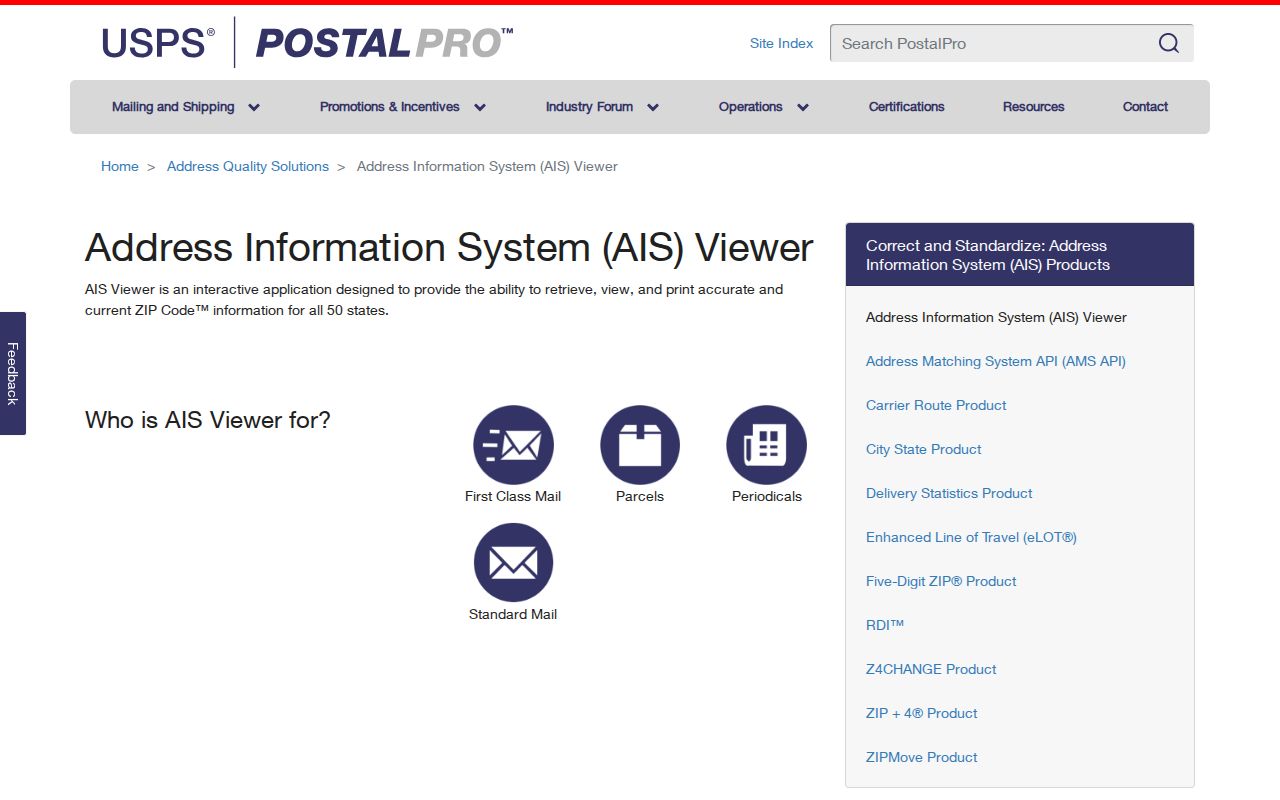
Its result is a postal verification point. It does not establish ownership, current occupancy, voting status, or a city jurisdiction.
| Input | Complete delivery address |
|---|---|
| Useful output | ZIP, ZIP+4, carrier route, county, and delivery point |
| Best use | Confirm the mailing geography before opening a local record search |
| Not shown | A complete resident or ownership list |
Search Cape Girardeau ZIP Code Records
A Cape Girardeau ZIP code directory can narrow the first question, but the next search should follow the record type. The County Collector's real-estate search accepts a name, address, or parcel, not a verified ZIP-wide filter. CAMAvision's live fields did not render during research, so no ZIP search mode is promised there. City PDF maps provide useful boundary context, but they are not resident-query tools. Start with the confirmed address, then move to the appropriate custodian.
- Check the full address in the USPS AIS Viewer and save the returned ZIP and county.
- Use the County Real Estate Search with the address or parcel number if the question concerns a parcel.
- Compare the parcel with the CAMAvision GIS map and the city boundary or annexation maps when jurisdiction matters.
- For a historical address, consult city directories at the library or archives, then verify the edition and street form.
Once a ZIP points to a particular road, the Cape Girardeau street directory gives the fuller address-to-parcel workflow. A ZIP alone should not be used to make a block-wide list.
Cape Girardeau ZIP Portal Limits
Local systems do not all sort records the same way. The Collector describes real-estate searches by name, address, and parcel, and advises using one criterion at a time. The Recorder indexes land through names, book and page references, dates, and legal descriptions across different historical periods. The City map collection offers static maps for streets, wards, precincts, historic districts, zoning, and annexation. None of those confirmed routes is a general ZIP-wide resident search.
That limitation protects accuracy. A property taxpayer can be an owner, an entity, or a mailing contact. A recorder grantee is a party to a document, not automatically a current occupant. A map parcel tells the researcher where to ask the next question. It does not prove who lives there. For city permit or historic file questions that do not appear online, use the City public-records request form and describe the address, date range, and record type.
Cape Girardeau City and ZIP Lines
Cape Girardeau's county and city address systems create a practical split. The County 911 address request route handles property outside the incorporated limits of Cape Girardeau and Jackson. For an address within either city, the county directs the requester to city planning. A postal label does not settle that question. Use the parcel map and the City of Cape Girardeau's downloadable GIS maps to check boundaries, wards, historic districts, and annexation context.
Annexation can change which government holds a permit, zoning, election, or address record. The city publishes an Annexation By Year map, while the Recorder's legal description and plat references remain the stronger bridge when an old listing and a modern address do not line up. No official street-renumbering chronology was found. Compare a historic directory street index, plat, Sanborn sheet, and council material for a specific change instead of assuming that an old number converts neatly.
Cape Girardeau Census ZIP Geography
The Census profile is useful for broad geography, but it uses ZCTAs rather than USPS delivery codes. For Cape Girardeau, the research identifies ZCTA overlap that includes 63755 and 63780 in addition to 63701 and 63703. That overlap is a reason to verify an address, not evidence that every location in those ZCTAs is a Cape Girardeau city address. A Census profile can describe an area, while an individual mail route remains a USPS question.
This distinction is especially helpful in family-history work. A city directory can show a street and a historic house number, while a Sanborn map or plat can show the older street context. Use postal information only after the address has been brought forward to a current form. A 1915 map, for example, is a record of its own time and does not carry a modern ZIP.
Note: Never convert a ZCTA, a postal label, or a historic directory entry into a claim about present residence without a current official record.
Cape Girardeau ZIP Boundaries
Postal vocabulary can make a Cape Girardeau ZIP code directory easier to read. It also prevents a search from joining records that belong to different places. A parcel number is the assessor or collector key. A legal description connects deeds and plats. A ZIP is a delivery-routing code. Each can be useful, but none should be substituted for the others.
- ZIP code
- The five-digit code USPS uses to route mail to a delivery area.
- ZIP+4
- An added four digits that narrow delivery handling for a specific block, building, or other segment.
- PO Box ZIP
- A postal code tied to box service, which is not a municipal boundary or an occupant list.
- Unique ZIP
- A code assigned for a particular organization or delivery arrangement, not proof of a surrounding neighborhood.
- Carrier route
- A mail-delivery grouping returned by USPS, useful for routing but not a property or residency record.
The safest close to a ZIP search is a source check: postal data with USPS, parcel facts with the assessor, deeds with the Recorder, and city records with the correct clerk or department. That division keeps Cape Girardeau searches specific and avoids treating a delivery code as a personal profile.
For older Cape Girardeau addresses, write down the exact form found in the source before applying a modern ZIP. A city directory, Sanborn map, plat, or deed can use a street form that predates a later boundary or delivery arrangement. The County Archive identifies a 1901 plat-map reference, a 1910 city-subdivision map, and Sanborn material as helpful historical bridges. Compare those sources with the legal description and a current parcel record. This method keeps a postal lookup from obscuring the date and place that an earlier record actually documents.