
Search Cape Girardeau Streets by Address
Use one street address as the starting point, not a street-wide name list. The County Assessor and CAMAvision map can connect a physical location with a parcel, owner record, legal description, and map position. The Recorder can then supply the recorded transfer trail. The Collector provides a separate tax-account check. For older households, the useful handoff is to dated city and criss-cross directories at local repositories. Each source answers a narrower question, which keeps a Cape Girardeau street directory search from treating ownership, mail delivery, and occupancy as the same fact.
- Enter the known location in the CAMAvision Real Estate Search, or locate it in the parcel map. Save the situs address, parcel identifier, legal description, and the owner name exactly as displayed.
- Open the same area in the CAMAvision GIS viewer. Check the road, parcel lines, city or county boundary context, and any visible map layers before moving to a neighboring parcel.
- Use the owner name and legal description in the Cape Girardeau County Recorder of Deeds route. Find the instrument in which that owner is the grantee, then note the grantor, recording reference, and prior-reference language.
- Compare the parcel with the County Collector real-estate search. It accepts name, address, or parcel searches and is useful for checking the account tied to the property.
- For a past household question, take the street spelling and date to the Library, SEMO Archives, or the County Genealogical Society. Dated directory and map evidence can support an address history, but it should not be turned into a current household list.
When a record is not online, do not substitute a guess. The Assessor can be reached by phone or email, the Recorder offers office, phone, and email routes, and the County Clerk accepts a signed public-records request for county material that is not in a searchable system. A useful request names the address, date range, record type, and preferred delivery format.
Cape Girardeau Street Record Chain
A street directory becomes reliable when the records are read as a chain. Address-keyed sources can identify a parcel, document a transfer, or place a name at an address in a particular historic edition. They do not have equal reach. The table separates the custodian from the kind of fact the record can support.
| Address Record | Cape Keeper | Useful Detail | Access Route |
|---|---|---|---|
| Parcel card | County Assessor | Parcel, situs, owner, values, legal description, improvements | CAMAvision search, office, phone, or email |
| Parcel map | Assessor and city GIS | Parcels, streets, boundaries, districts, zoning, flood context | CAMAvision viewer and city map downloads |
| Tax account | County Collector | Taxpayer or account tied to a name, address, or parcel | Online search, counter, or phone |
| Deed or plat | County Recorder | Grantor, grantee, date, book/page, legal description, lot or block | Remote routes, office search, phone, email, or records request |
| Permit file | City Development | Address-specific applications, attachments, or work history if public | MUNIS route or City records request |
| Directory or map | Library, SEMO, CCGS, County Archive | Historical address, household, street, building, or neighborhood context | Repository visit, microfilm, printed material, archive inquiry |
The presence of a name on a parcel or tax account does not establish present residence. A parcel can have a trust, estate, business, or off-site mailing contact. A city directory can show a household for its edition year, while a Sanborn sheet shows the street and building context. Keep the record date beside every conclusion.
Note: The live parcel card and full external recorder search controls were not captured in the research, so confirm labels and result details during each search.
Cape Girardeau Street Directory Fields
The County’s Assessor links to the CAMAvision Real Estate Search and GIS map. The research verified the entry routes but did not render a live parcel card. That matters because the exact label, required status, and result behavior of each control should be checked at search time. Use the visible record as the authority instead of assuming that a field is available.
| Portal Control | Research Status | How It Helps an Address Search |
|---|---|---|
| Real Estate Search: name | Control expected; exact matching behavior was not rendered | Start with the exact owner spelling from a current public record. |
| Real Estate Search: address | Control expected; number, unit, and street-only behavior require verification | Test the known address rather than assuming a whole-street browse exists. |
| Real Estate Search: parcel or account | Expected core identifier; live label not captured | Use a parcel number from a tax bill or recorded instrument when available. |
| GIS: map search or identify | Map and Layers function documented; exact search panel not captured | Locate the parcel, preserve its identifier, then check the adjacent street context. |
| GIS: layers | Official material describes parcels, streets, boundaries, flood, zoning, districts, schools, wards, police/fire, utilities, and annexation | Use the layer legend for geography, not for a person list. |
The County says certified-year values update annually after the Board of Equalization process, while ownership and mapping update as transfers are processed. New construction permits from Cape Girardeau and Jackson are reviewed monthly. Those update practices make the assessor record valuable for a parcel trail, but an assessment update is not a move-in date or proof of occupancy.
Map a Cape Girardeau Street
Start the street-by-street pass in the CAMAvision parcel map. The official materials describe parcel and boundary lines, addresses and streets, parks, schools, voting districts, flood zones, zoning, special tax districts, and public-service layers. City downloads add historic districts, wards, precincts, school boundaries, utility districts, and Annexation By Year context. These layers are especially useful when a Cape Girardeau mailing address may fall outside the incorporated city.
The CAMAvision map displays the parcel-viewer route used for this part of a Cape Girardeau street directory search.
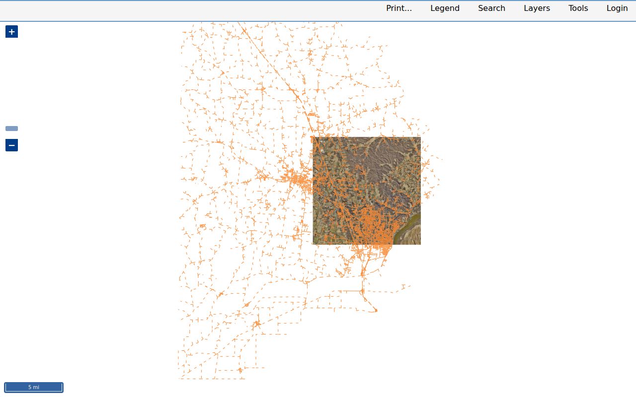
Use the map to preserve a parcel identifier and its spatial context. The live identify panel, buffer tools, print function, and export behavior were not captured, so do not promise a map download or a complete street result before confirming the current interface.
For a single segment, zoom until the street and parcel geometry are clear, record each parcel identifier separately, and then open the supporting assessor or recorder record. This avoids merging a nearby parcel with the target parcel just because the street names match.
Trace Cape Girardeau Street Deeds
The County Recorder’s index begins in 1805. Its published routes divide the material by era: historic deed books run from 1805 through 1964; deeds from 1984 forward are fully indexed; and deeds from 1965 through 1983 are described as Book/Page-only. The comparable fully indexed deed-of-trust range begins in 1984, while 1970 through 1983 is Book/Page-only. Plats extend from 1806 forward through the Fidlar route, and surveys from 1991 forward provide later boundary context.
Begin with the current owner as grantee on the most recent purchase deed. Read the deed for the seller, called the grantor, the legal description, the recording reference, and any earlier reference clause. Next, search that seller as grantee to locate the prior acquisition. Continue backward one documented transfer at a time. A deed of trust records a financing instrument, not a transfer of possession, so it should not replace the deed chain.
- Parcel
- A parcel is the assessor and GIS unit for a defined piece of land. It ties a mapped location to a property record.
- Situs address
- The physical location used for mapping, inspections, zoning, and city or county jurisdiction. It can differ from the owner’s correspondence address.
- Plat
- A recorded map that identifies a subdivision, lot, block, streets, or easements. A plat-book/page reference can bridge address changes.
- Criss-cross directory
- A historical directory arranged by address or street rather than by surname. It is evidence for the specific edition, not a current roster.
The Recorder’s office is at #1 Barton Square, Suite 203, Jackson. Office research, phone assistance at 573-243-8123, and recorder@capecounty.us are useful when a historic item is not reachable online. Staff can help operate equipment but do not conduct title research. For older Book/Page-only material, bring the precise reference or ask how to access the book, microfilm, or office record.
Check Cape Girardeau Street Files
The County Collector supports a second address-based check. Its real-estate search accepts a name, address, or parcel number, and the County advises using one criterion at a time. A name needs to match the bill exactly. Counter and phone help are also available, including the Cape Girardeau office at 2311 Bloomfield Road, Suite 102, 573-335-2606. The tax record can corroborate an account tied to the property, but it still is not an occupancy record.
For building, zoning, subdivision, demolition, nuisance, or historic-preservation files, City Development is the proper Cape Girardeau handoff. MUNIS Citizen Self-Service is the documented route for applications and payments, but research did not locate a searchable public permit-results screen. Request an address-specific historical file through the City rather than inventing a search workflow.
Cape Girardeau’s public-records form is the documented request channel for city-held records.

The form asks for contact information and a description of the documents requested, then requires acceptance, reCAPTCHA, and submission. It directs vital records and police, accident, criminal, and jail requests to other custodians. City copy and research charges can change, so confirm the current fee notice before making a request.
Note: A precise address, document type, date range, and desired format make a City or County request easier for the custodian to route.
Cape Girardeau Street Address Boundaries
Cape Girardeau street records split between city and county jurisdiction. The County 911 addressing form is for property outside incorporated Cape Girardeau and Jackson. Within either incorporated city, the County directs address requests to the appropriate city planning office. A postal address bearing the Cape Girardeau name can therefore sit outside city limits, while city services and annexation history can change which office holds a permit or zoning record.
Keep the address components distinct. The situs is the physical location. A mailing address sends assessor or tax correspondence and may be elsewhere. The legal description, which can be lot/block/subdivision, plat-book/page, or metes-and-bounds language, is often the more stable bridge when a street spelling or number changes. A parcel or account number is the assessor and collector key, while recorder instruments may rely on legal description and book/page.
No official complete chronology of Cape Girardeau street renumbering or renaming was found. For a historical discrepancy, test more than one street form and compare the legal description, historic plat, directory street index, Sanborn map, council material, and annexation-by-year map. Record an earlier address as an earlier address instead of silently converting it to a modern label.
Read Cape Girardeau Street History
Older Cape Girardeau street evidence is scattered by format. The Recorder reports its first recording on June 14, 1805, with documents reaching into the 1790s. The County Archive identifies Spanish land-grant maps, a 1901 plat map, a 1910 city-subdivision map, and Sanborn materials. The Library of Congress 1915 Sanborn set has 23 sheets, and official historic documentation identifies local Sanborn years from 1884 through 1931. A sheet can show building use, footprint, materials, street names, and lot context, but not a complete list of residents.
Historical directories add the people layer only for the edition searched. Cape collections include a 1906 Daily Republican directory and Polk editions beginning in 1910, with documented runs through 2000 but uneven holdings. The Library’s Kirby Genealogy Room, SEMO Special Collections, the Cape County Genealogical Society, and the Historical Society are the appropriate places to ask for a particular street or directory year. The historical collections themselves are described in the Cape Girardeau city directory resource.
The Red Star neighborhood’s factory-era story is a useful local example of why old street work takes several sources. Directories, local papers, maps, and SEMO’s Glenn House Collection can add context to an address without claiming that a factory reference proves where a person lived.
Cape Girardeau Street Voter Limits
Missouri’s voter portal is an individual verification tool, not a street directory. It instructs a voter to enter registered information exactly, including identifying fields and address components. RSMo 115.157 identifies public voter-record fields and restrictions, while RSMo 115.163 addresses inspection of precinct registers. Protected addresses and Safe at Home participants must not be exposed or inferred from a street search.
For a defined historic election, precinct register, or election record, contact the Cape Girardeau County Clerk and Election Authority at the Copper Dome courthouse or use its records-request route. The office asks for a signed, dated request with valid contact information and a description. It states a response target no later than the end of the third business day, subject to retrieval, research, reproduction, and any fee notice.
Cape Girardeau Street Directory Limits
A Cape Girardeau street directory cannot show every person connected with a home. The Assessor normally records property facts, not a household list. A tax bill can name a taxpayer or contact. A recorded deed shows parties to an instrument, while an old directory shows a dated printed entry. Utility customer data is not public, and Missouri driver-record information is restricted under the Driver Privacy Protection Act.
Use a dated source for a narrow conclusion and preserve its custodian and identifier. If a parcel card, map, or deed image includes sensitive identifiers, do not republish them. Questions about redaction or a recorder image should go to the Recorder; questions about a city-held file should go to the City Clerk. A missing result may reflect a date gap, a different custodian, or a protected record, not proof that no connection existed.